7477
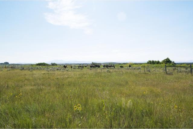
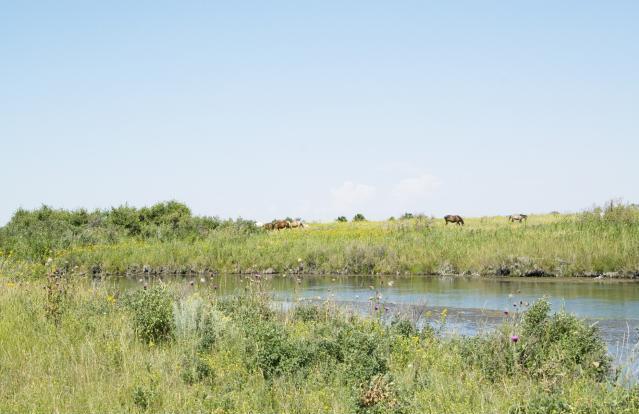
When HBC Chief Trader Richard arrived at Fort Hall in the 1840s, there were millions of buffalo; this landscape would have been a breathing brown carpet. This day, seeing even this small herd of these massive, magnificent beasts in its natural habitat was an incredibly breathtaking experience.
Friday, August 9, 2013 THE BOTTOMS
7480
Ghost Road. So named for the old woman seen walking the road. As drivers slow to offer her a ride, she disappears. As we approached our turnoff, off to the right, a magnificent chestnut horse raised its head. In what seemed recognition, and without hesitation, it started galloping towards us. The horse waited for us in the middle of the road at the turnoff, turned when we arrived and led us a long distance down that road before returning to the grasses. Perhaps there was a different ghost with us this day; maybe Richard or Johnny Grant welcoming us home.
7519
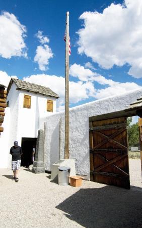
During the time Richard Grant was Chief Trader of Fort Hall, the British flag, with the initials HBC woven on it, flew over the fort.
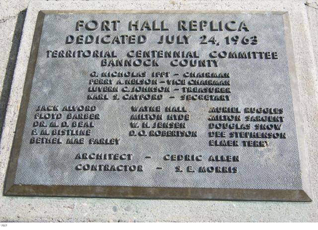
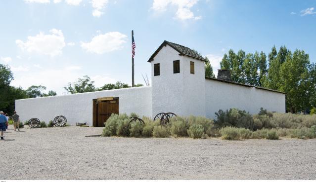
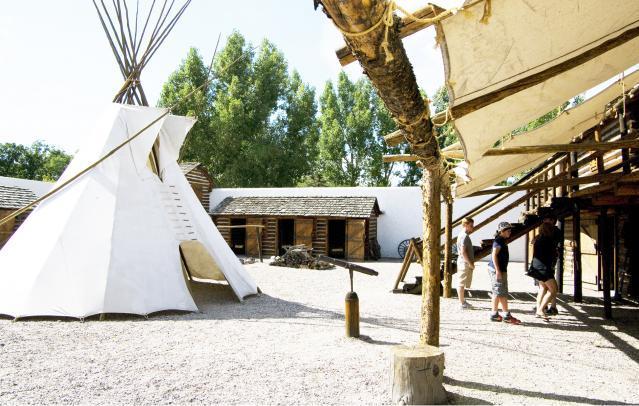
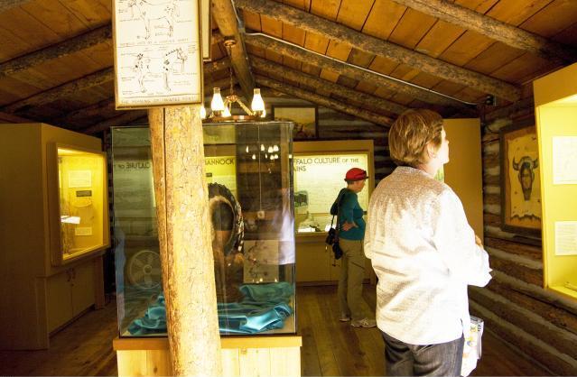
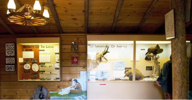
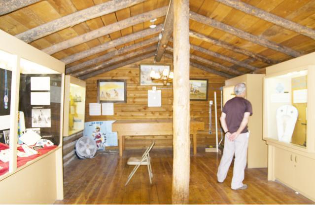
7512 Fort Hall Replica
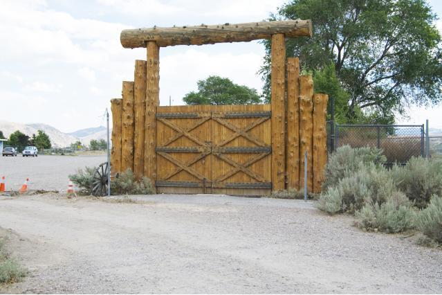
7509 Replica of the original Fort Hall gates
Friday, August 9, 2013 FORT HALL REPLICA
7507
Jacquee Alvord
Former Marine, Local historian, Member of Fort Hall Replica Commission,
Recipient of the Certificate of Appreciation awarded by the Mayor of Pocatello.
Tour guide Extraordinaire for our Idaho Grant Reunion.
7506 Uncle Mike? Uncle Peter?
(The Bottoms are also known for some very mysterious 'occurrences'...)
7499
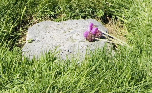
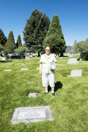
Richard Grant, our first Canadian ancestor, was born in Montreal; never set eyes on Scotland. Had his father, William Grant of Troi-Rivieres, though, gazed upon these thistles and waters, would he have been reminded of his distant home? A bouquet of thes thistles & grass, bundled in a braided ribbon of red aran wool, was a fitting sentiment for the graveside ceremony of Richard Stanislas Grant.
7498
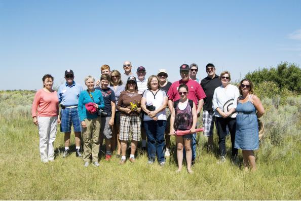
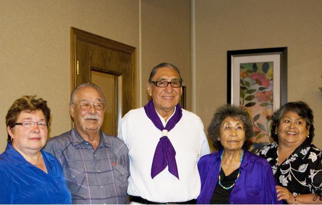
Front: Olivia Cameron, Nancy Grantham (Olivia's Mom)
Centre L-R: Sally Grant, Hans Baier, Penny Grant, Brendan Smith, Betty Baier, Kathryn Brolliar, Barbara Cochran
Back L-R: Jordan Smith, Elspeth Grant-Smith, Glen Smith, Jim Cameron, Marilyn Cameron, Sam Cameron, Mark Cameron
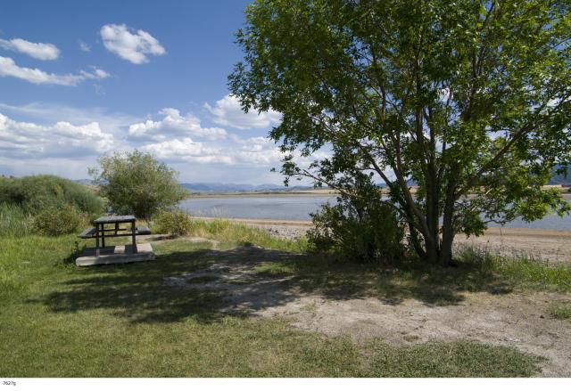
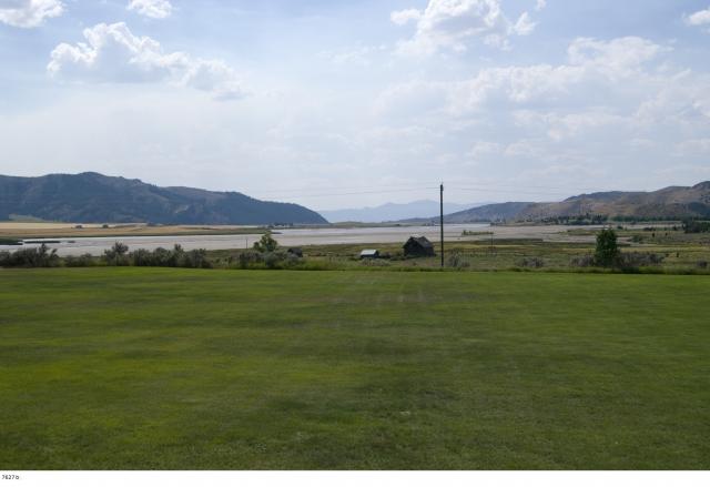
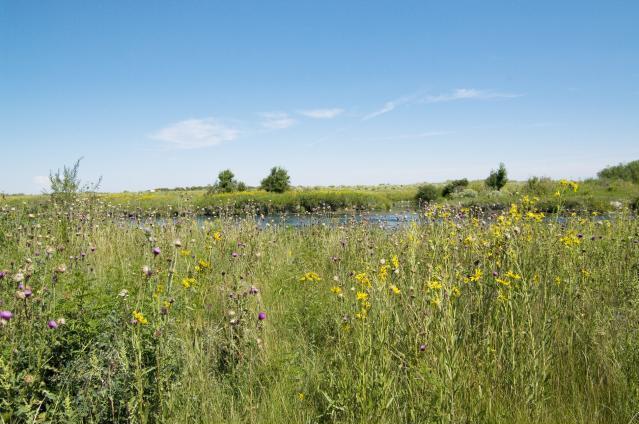
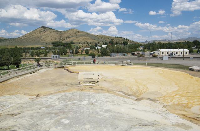
Grants on The Bottoms ~ The site of the original Fort Hall is generally referred to as 'The Bottoms'. It is a sheltered area in the bend of the Snake River near the junction of the Blackfoot and the Portneuf Rivers. Plentiful in fish and game, it was long used as a gathering and camping place by Shoshone and Bannock Indians. This was our first attempt to find the marker at the exact site of the fort. Our search was unsuccessful, but we had a great time looking. Unbelievably beautiful area!
7492 Grants at The Bottoms
L-R: Barbara Cochran, Nancy Grantham, Sam Cameron, Olivia Cameron, Glen Smith, Elspeth Grant-Smith, Penny Grant
7524b
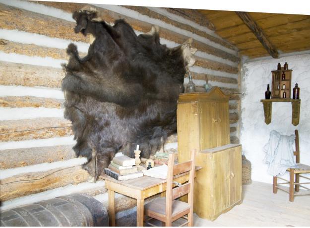
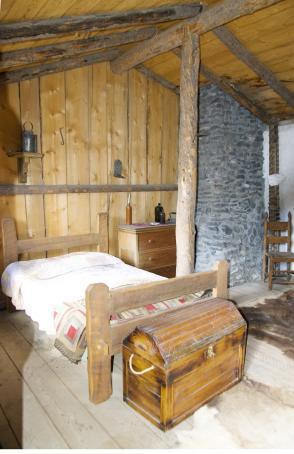
First room of Richard Grant's living quarters. (Right)
7524
First room of Chief Trader Richard Grant's living quarters. (Left)
Rooms 1 & 2 were each approximately 15 x 17 feet.
7522
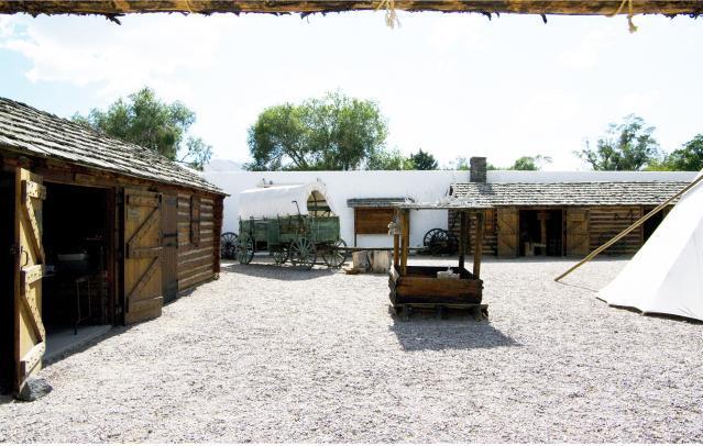
Fort Hall Replica courtyard. The stairs lead to three rooms on the second floor. In the original fort, two small rooms would have served as living quarters for Chief Trader Richard Greant and his family. One large room would have been available for their use when not needed by the HBC for other purposes.
7524a
First room of Chief Trader Richard Grant's living quarters. (Centre)
7532
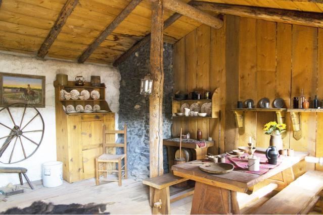
Second room of Chief Trader Richard Grant's living quarters. (Left)
7532a
Second Room of Chief Trader Richard Grant's living quarters. (Centre)
7520 Fort Hall Courtyard - L: Office; Centre Back: Blacksmith Shop.
7532b
Second room of Chief Trader Richard Grant's living quarters. (Right) When his sons rejoined Richard on August 3, 1847, the family would have included Richard and his 2nd wife, Helene; Helene's daughter from her first marriage, Jemima Kittson; Richard's sons from his second marriage, James Cuthbert Grant; Richard & Helene's daughters, Helene, Julia and Adelina Grant; Richard's sons from his first marriage, John Francis and Richard Stanislas Grant with his pregnant wife, Emilie. Joseph Richard Grant was born only one month later, on September 7.
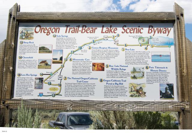
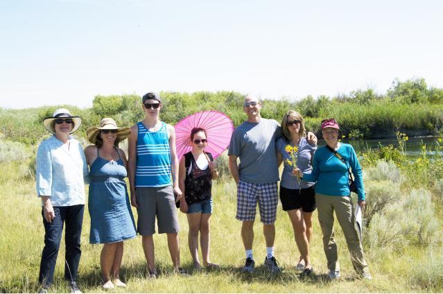
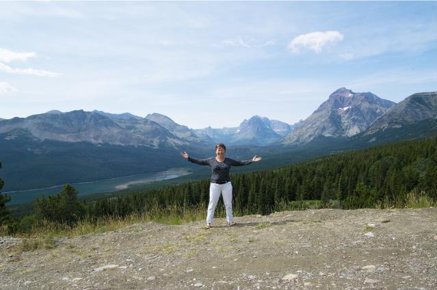
2616
Sheep Rock aka Sheep Mountain on the Oregon Trail. It was at this point imigrants had to decide which trails they would take to their destination.
Ellen Carney giving a history lesson to Mark Cameron, Marilyn Grant Cameron and Peter Grant.
7540
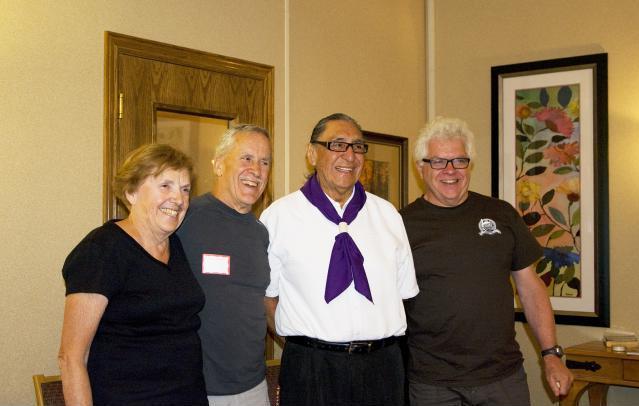
L-R: Anita Steele, Jeff Anderson, Peter Grant
Jeff Anderson is Fairview Cemetery's sexsmith. My correspondence with Jeff began about twenty years ago. His identification of the "lava rock marker' provided validation of the family story relating to the death and burial of our ancestor, Richard Stanislas Grant. Meeting Jeff was a surprise and an honour and definitely a highlight of the reunion!
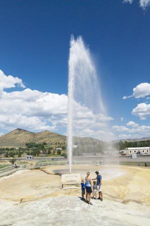
7578
Soda Springs geyser. The geyser is timed to blast at least 100 feet in the air every hour. Its mean temperature is seventy degrees fahrenheit.
7557
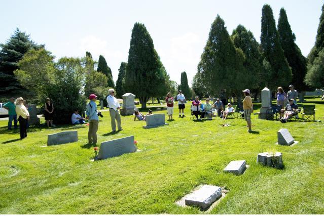
After placing roses on Richard's markers, everyone was given an opportunity to speak to this celebration of his life. Betty Grant Baier, a Johnny Grant descendant, is one of many whose Metis history was hidden until recent years. All of the children present read from a biography written by Penny Grant, giving promise to a future of remembrance, acknowledgement and pride
7583
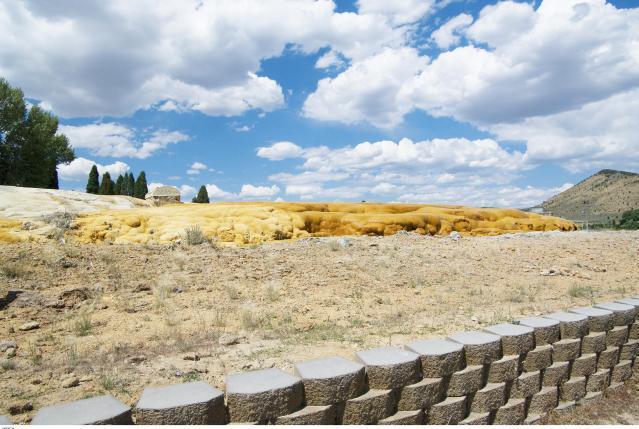
Soda Springs geyser - 76 years of the geyser's mineral deposits - looks like something escaped from a sci-fi lab!
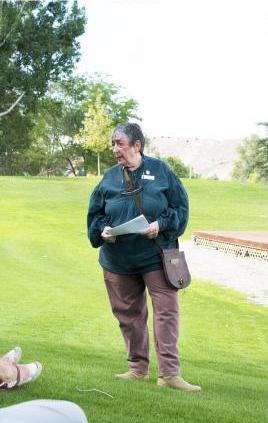
7565 Ellen Carney, B.A., M.A.
Teacher, Caribou County Historic Preservation Commissioner (3 terms), newspaper correspondent, award winning author, tour guide extaordinaire.
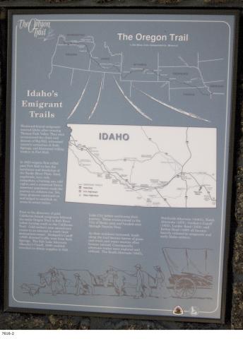
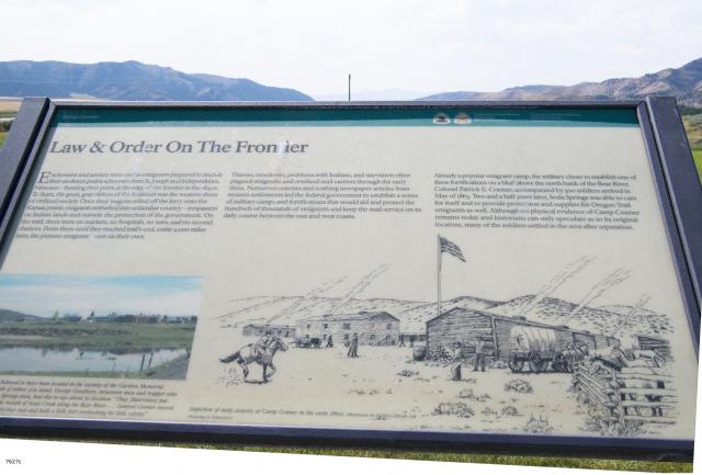
Historic Landmarks
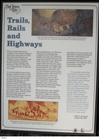
Trails, Rails and Highways
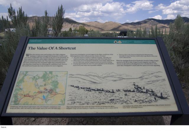
This is an east-west travel corridor of the earliest emigrant trails that continued even after the arrival of railroads and highways. Early explorers such as John Fremont, Jedediah Smith, Osborne Russell, and missionary Narcissa Whitman were among the first to describe this route.
It was the original route of the Oregon-Claifornia Trail in 1840. The first known emigrant group to pass along the trail though the Soda Springs area was the California bound Bidwell-Bartleson Party, who began their journey in the spring of 1841. The trail was heavily used from 1849 until about 1859. The opening of the Lander Trail, which provided fresh food and water and bypassed Soda Springs, reduced travel along this route.
The establishment of a Mormon settlement at Soda Springs, coupled with the 1871 discovery of gold at Carriboo Mountain 40 miles north of the town, increased traffic along this route. These wagon roads were the only means of moving people and supplies into and through the area. After 187, freight wagons connected with the Utah Northern narrow-guage railroad at Arimo (then known as Oneida Station) to the west. Following the arival of the standard-gauge Oregon Short Line railroad in 1882, Soda Springs became the primary station stop in southeastern Idaho and road traffic increased.
7544
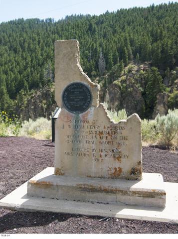
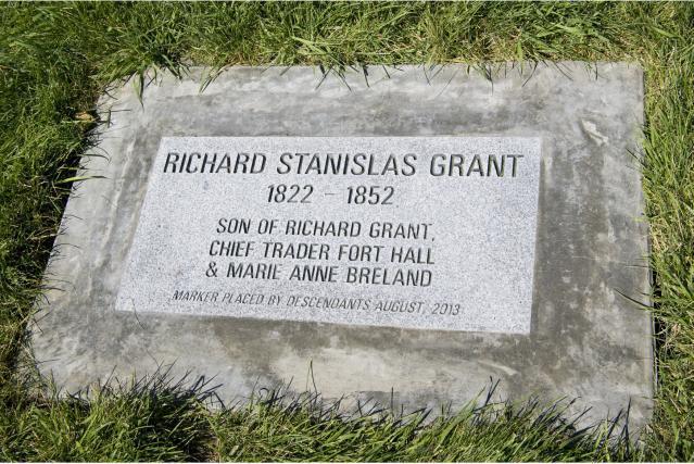
When Richard Stanislaus died in 1852, he was buried at Steamboat Spring on the Bear River. On July 2, 1924, flooding resulting from the construction of the Alexander Dam on the Bear River necessitated reburial at higher ground. According to the family story, "friends moved him and marked his new grave with a large lava rock". No one any longer remembers who those friends were, but because they took the time and care to smooth the sides and corners into approximately a 14 inch square block, and place it here, we were able to find and identify the grave 75 years after the reburial. Had Richard remained at his original location, his grave would have been under water. Interestingly, there were two other graves relocated at the same time. One record indicates the two other persons rest here with Richard.
The Scottish Thistle symbolizes bravery, courage, loyalty, endurance and fortitude - in short - "Stand Fast, Craig Elachie!" These thistles come from "The Bottoms", the area of the original Fort Hall, which was managed by Richard Stanisas' father.
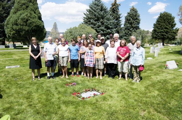
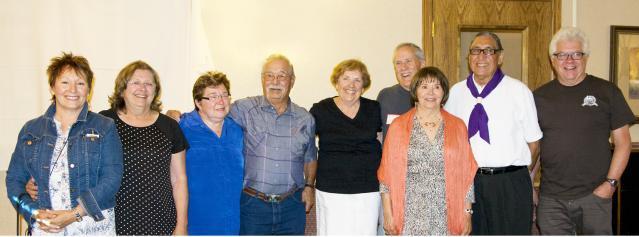
7564 Fairview Cemetery, Soda Springs
Front L-R: Barbara Cochran, Jim Cameron, Marilyn Cameron, Brendan Smith, Nancy Grantham, Olivia Cameron, Betty Baier, Anita Steele, Kathryn Brolliar, Penny Grant
Back L-R: Ellen Carney, Lew Carney, Jordan Smith, Glen Smith, Mark Cameron, Elspeth Grant-Smith, Sam Cameron, Hans Baier, Skip Brolliar, Peter Grant, Mike Grant
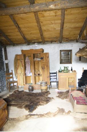
7534, 7534a, 7534b:
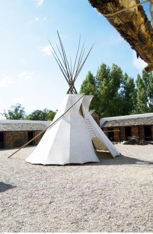
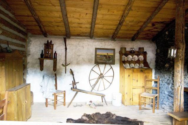
This single room is about three times the size of either of Richard Grant's living quarters. When not needed by the HBC for other purposes, it was used a part of Grant's living quarters. Today, it is a museum depicting Native American culture of the fur trade period.
7585
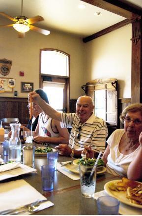
Lunch in Soda Springs was the popular Enders Hotel & Museum. Dining amidst antiques ranging from furniture to Hollywood memorabelia...atmosphere...super food and great service. Here, Jim Cameron shows off his genuine Idaho French fry. WOW! 5 potatoes to a 10 pound bag?!
7545 Not Forgotten
7570
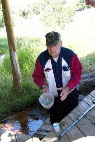
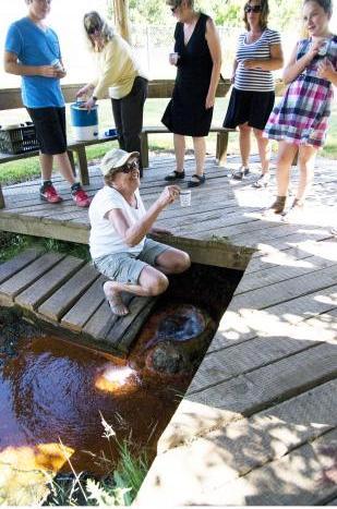
Soda Springs. Waiting for the erruption...
In 1937, a man drilling for water ruptured an underground chamber. The resulting geyser sprayed continuously, so was capped and controled to prevent the source from being exhausted.
7534b
Grant's spare living quarters - when not needed by HBC for other purposes.
7532c Cozy
or
Cramped?!
7534a
Grant's spare living quarters when not needed by HBC for other purposes
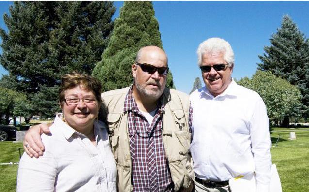
7503 A MacRobbie Moment
7681
Special guest, Howard Doore, (3rd from left) with Marilyn Cameron and her brothers, Mike (L) and Peter (R) Grant
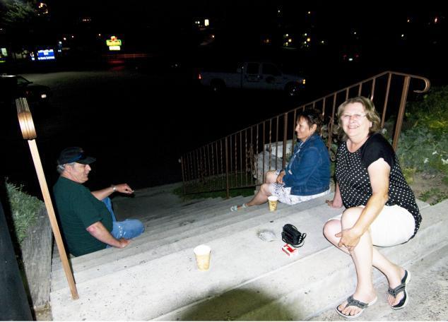
7682
Sunday, August 11, 2013. Midnight goodbyes ~ Skip & Kathryn Brolliar and Sally Grant (centre).
7342
Sally Grant Our Grant Reunion Was This Great!!!
Saturday, August 10, 2013 Historic Landmarks
7641
Lew Carney ~ Sparkling lemonade from natural soda water. (It was 94F in the shade!)
7638
Marilyn Cameron ~ Going for the brew.
7639
7642
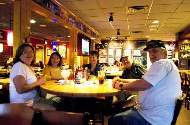
Saturday, August 10,2011 ~ Family Dinner
L-R: Kathryn Brolliar, Betty Baier, Sally Grant, Hans Baier, Skip Brolliar
7679
Sunday, August 11, 2011 ~ Family Reunion Dinner
L-R: Anita Grant Steele with special guests, Raymond LaVatta, Howard and Geraldine Doore, Elizabeth LaVatta. Anita and Raymond are related through the marriage of Laura Delores LaVatta and Joseph Richard Grant (Son of richard Stanislas Grant). Howard is our most recent MacRobbie Grant find. He is a descendant of James Cuthbert Grant, son of HBC Chief Trader Richard Grant and his second wife, Sarah aka Indian Woman at Oxford House.
7680
L-R: Sally Grant (Alberta), Kathy Brolliar (Oregon), Anita Grant Steele (Yukon), Raymond LaVatta (Pocatello, Idaho), Marilyn Grant Cameron (British Columbia), Mike Grant (British Comumbia), Betty Grant Baier (British Columbia), Howard Doore (Pocatello, Idaho), Peter Grant (British Columbia).
All are descendants of HBC Chief Trader Richard Grant and Marie Anne Breland, excepting Raymond LaVatta (4th from left) and Howard Doore (2nd from right). Raymond is related to Anita through Joseph Richard Grant & Laura Delores LaVatta; Howard is a descendant of James Cuthbert Grant, son of Chief Trader Richard Grant and his second wife, Sarah aka Indian Woman at Oxford House, Manitoba. This is a first meeting with Howard.
7521 Fort Hall Courtyard
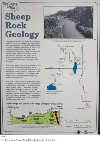
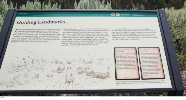
Sheep Rock Geology
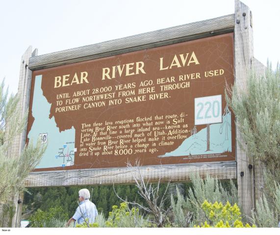
Lava eruptions west of Sheep Rock at least 140,000years ago blocked the Bear River from draining into the Snake River system. Instead, the Bear was forced to drain into what was the Lakes Thatcher and Bonneville to the south. The Bear River's course forms a giant horseshoe shape between its source in the high Unita Mountains of eastern Utah and where it enters the Great Salt Lake northwest of Ogden.
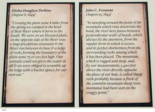
This high, rocky, abrupt termination of the mountain, a prominent Oregon Trail landmark, is the northern terminus of the Bear River Range, which is continuous with the Wasatch Mountains. The Bear River flows around the base of the mountain before turning south.
Just west of Sheep Rock is Alexander Crater, a basaltic cinder cone less than 20,000 years old that was mentioned in several Oregon Trail diaries. John C. Fremont, in 1843, described Alexander Crater as a "a Very perfect crater.." He noted the walls "were Perfectly vertical and disposed like masonry in a very regular manner..." In recent years the crater has been mined for gravel and landscaping materials.
Nearby Alexander Dam was built on the Bear River in 1923, forming Alexander Reservoir.
When the future state of Idaho was designated as the Idaho Territory in 1863, the existing wagon routes became territorial roads under the jurisdiction of the government. It was not until well after Idaho attained statehod in 1890 that road building and maintenance became a centralized function of the state government. U.S. Highway 30 in southeastern Idaho was constructed in 1926.
John C. Fremont
August 26, 1843
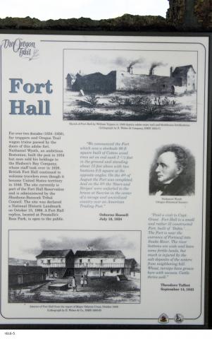
Fort Hall
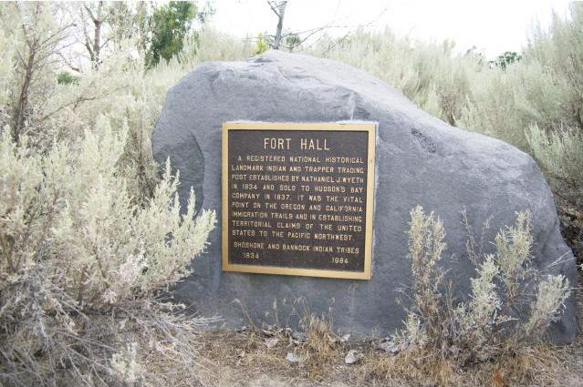
For over two decades (1834-1856) fur trappers and Oregon Trail wagon trains passed by the doors of this adobe fort. Nathanial Wyeth, an ambitious Bostonian, built the post in 1834 but soon sold his holdings to the Hudson's Bay Company, whose staff took over in 1838. British Fort Hall continued to welcome travelers even though it became United States territory in 1846. The site currently is part of the Fort Hall Reservation and is administered by the Shoshone-Bannock Tribal Council. The site was declared a National Historic Landmark on October 15, 1966. A Fort Hall replica, located at Pocatello's Ross Park, is open to the public.
< Interior of Fort Hall from the report of Major Osborne Cross, October 1849. Lithograph by E. Weber & Co.
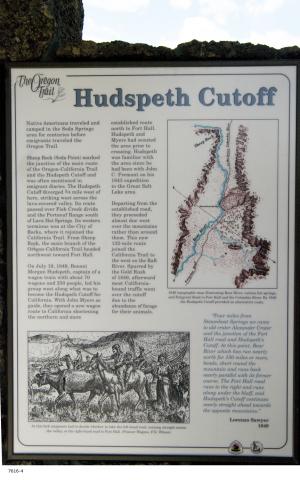
Departing from the established road, they proceeded
almost due west over the mountains rather than around them. This new
132-mile route joined the California Trail to the west on the Raft
River. Spurred by the Gold Rush of 1849, afterward most California-bound
traffic went over the cutoff due to the abundance of rorage for their
animals.
Lorenzo Sawyer
1849
When the Applegate Route from Humboldt, Nevada to Dallas, Oregon opened in the fall of 1846, Oregon bound emigrants were able to choose an alternative to floating down the Columbia River. A few years later, Hudspeth's Cutoff made this option even more appealing.
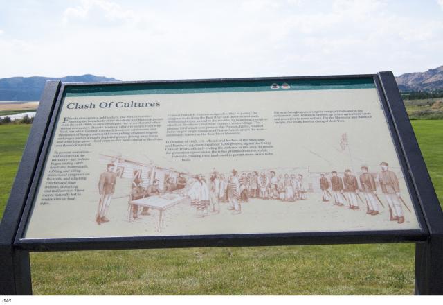
Clash of Cultures
Floods
of emigrants, gold seekers, and Mormon settlers entering the homelands
of the Shoshone and Bannock people from the mid-1840s to early 1860s
gave rise to conflict and often violent encounters. Despite Mormon
efforts to supply them with food, starvation loomed. Livestock from new
settlements and thousands of hungry oxen and horses pulling emigrant
wagons and stage coaches annually depleted grasses driving away bison
and other large game---food sources that were critical to Shoshone and
Bannock survival.
To prevent starvation--and to drive out the intruders--the Indians began raiding cattle herds and homesteads, robbing and killing miners and emigrants on the trails, and attacking coaches and stage stations, disrupting vital mail service. These events naturally led to retaliations on both sides.
Colonel Patrick E. Connor, assigned in 1862 to protect the emigrant trails along the Bear River and the Overland maail, determined to put an end to the troubles by launching a surprise attack on Shoshone Chief Bear Hunter's winter village. The January 1863 attack near present day Preston, Idaho, resulted in the largest single massacre of Native Americans in the west--infamously known as the Bear River Massacre.
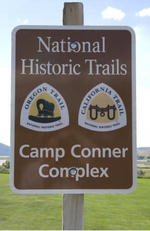
In October of 1863, U.S. officials and leaders of the Shoshone and Bannock, representing about 5,000 people, signed the Camp Connor Treaty, officially ending the violence in this area. In return for government provisions, the tribes promised not to trouble travelers crossing their lands, and to permit more roads to be built.
The treaty
brought peace along the emigrant trails and in the settlements, and
ultimately opened up prime agricultural lands and resources to more
settlers. For the Shoshone and Bannock people, the treaty forever
changed their lives.